
What's in this market read
- What a property survey actually measures
- Why a buyer or lender might ask for one
- Property survey vs title search: two different questions
- The main types of property survey
- Boundary survey: the baseline version
- Mortgage/location survey: what lenders sometimes want
- ALTA/NSPS survey: the commercial-grade version
- Topographic and as-built surveys: when those come up
- What drives property survey cost
- Illustrative property survey cost by type
- Why lot size, terrain, and history change the price
- Who typically orders and pays for the survey
- When a survey is required versus optional
- What a surveyor actually does on site
- Reading a survey: pins, monuments, and the plat
- What happens when a survey finds an encroachment
- Easements, setbacks, and why they matter
- Survey timing and how it fits the closing timeline
- New construction and surveys
- Rural, acreage, and irregular-lot considerations
- How survey cost fits inside the rest of closing costs
- A worked example: one lot, three survey types
- Common property survey mistakes
- Questions to ask before you hire a surveyor
- A property survey checklist
- The bottom line
Short answer: A property survey is a physical, on-the-ground measurement of a parcel's legal boundaries, performed by a licensed surveyor, and it typically costs anywhere from a few hundred dollars for a basic boundary survey to several times that for a full ALTA survey. It answers a different question than a title search: a title search confirms legal ownership on paper, while a survey confirms where the lines actually sit relative to fences, structures, and neighboring parcels.
What is a property survey, what does a property survey cost, and when does a home purchase actually need one? A property survey is a measurement of a parcel’s legal boundaries carried out on site by a licensed surveyor, who uses recorded deeds, prior survey records, and physical monuments found on the ground to establish exactly where a property’s lines fall. It is a different document, answering a different question, than the title search most buyers already associate with closing. A title search tells you who legally owns a property and whether any liens or claims exist against it. A survey tells you where that property physically sits, down to the foot, relative to the fence the neighbor built, the driveway that might cross a line, and the shed in the back corner of the lot.
This market read works through property surveys end to end: what a surveyor actually measures and produces, why a buyer or lender might require one, how it differs from a title search, the main types of survey and which one a typical home purchase actually needs, what drives the cost up or down, who commonly pays, what happens when a survey finds a problem, and how survey timing fits into a normal closing schedule. It pairs with our title search explainer and our title insurance market read, and the survey cost companion on this page reprices an illustrative estimate on your own lot. Once you have a cost figure, weigh it against the rest of your purchase budget in the affordability calculator.
Key takeaways
- A property survey physically measures where a parcel's legal boundaries fall; a title search confirms legal ownership and liens on paper. They answer different questions, and many closings use both.
- Cost varies by survey type, lot size, terrain, and record history, commonly running from a few hundred dollars for a basic boundary survey to several times that for a full ALTA survey.
- Who pays is a matter of local custom and the purchase contract, not a fixed rule, so confirm it in your own agreement rather than assuming.
- Not every purchase needs a new survey. One becomes practically necessary when no recent survey exists, a lender or title insurer requires one, or a boundary question has already come up.
- When a survey finds an encroachment, the usual paths are removing the item, recording a boundary agreement, renegotiating terms, or in serious cases walking away under a contingency.
What a property survey actually measures
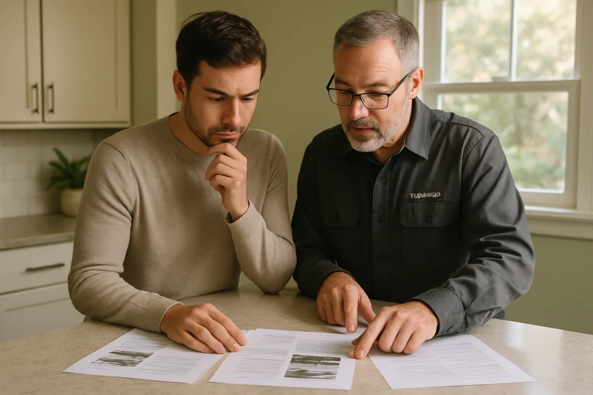
A property survey is the physical act of locating a parcel’s legal boundaries on the ground and documenting them on a drawing called a plat. A licensed surveyor starts with the recorded legal description from the deed, researches prior surveys and recorded plats for the area, then goes to the property itself to locate existing monuments, the iron pins, concrete markers, or other physical markers that past surveyors left at corners, and to measure distances and angles between them using professional equipment. Where a monument is missing or disturbed, the surveyor re-establishes its likely original position using the recorded description and nearby monuments as reference points.
The finished product is a drawing, or plat, showing the parcel’s boundary lines, its dimensions, the location of any structures, fences, and driveways relative to those lines, and often easements, setbacks, and other features the client or lender asked to have documented. That drawing is the thing a buyer, lender, or title insurer actually relies on, not a verbal assurance from anyone involved in the sale.
Why a buyer or lender might ask for one
A buyer typically wants a survey for the same reason they want a home inspection: certainty about exactly what they are purchasing before money changes hands. Knowing the precise boundary matters for fencing, landscaping, additions, pools, and simply understanding how much usable land actually comes with the purchase price. A lender or title insurer asks for one for a narrower reason, to confirm that the property being financed or insured matches its legal description and that no undisclosed encroachment or boundary problem exists that could affect the collateral’s value or the clarity of the title.
Not every transaction triggers this requirement. Many lenders and title companies are comfortable relying on an existing recent survey, an affidavit from the seller, or a title policy that accepts certain survey-related risk without a brand new survey being ordered. Whether a new one is required in your own purchase is a question for your lender and title company specifically, not a universal rule.
Property survey vs title search: two different questions
It is worth separating these clearly because buyers frequently conflate them. Our title search explainer covers what a title search actually does: it combs public records for the chain of ownership, outstanding liens, judgments, and other claims against the property, producing a picture of who legally owns it and what, if anything, clouds that ownership. None of that work involves anyone visiting the property or measuring anything physical.
A survey does the opposite. It does not research ownership history at all; it measures the physical land and compares that measurement against the legal description on record. A title search can come back entirely clean while a survey reveals a neighbor’s shed sits three feet onto the surveyed property. A survey can confirm perfectly clean boundaries while a title search turns up an old unreleased lien that has nothing to do with where any fence sits. Because they answer different questions, many purchases, particularly ones involving a lender or certain title coverage, use both, and treating one as a substitute for the other is a common and avoidable mistake.
The main types of property survey
Several distinct survey products exist, and the right one depends on what question is actually being asked.
- Boundary survey. The baseline version: establishes and marks the property’s legal corners and lines. This is the survey most ordinary residential buyers think of when they hear the word.
- Mortgage or location survey. A lighter-weight version some lenders accept, showing the general location of structures relative to boundaries without the same precision or monument-setting as a full boundary survey.
- ALTA or NSPS survey. The most detailed and standardized version, built to a national specification covering easements, encroachments, utilities, and other title-related items, common on commercial deals and complex or high-value residential parcels.
- Topographic survey. Maps elevation and land contours rather than just boundaries, typically ordered ahead of construction, grading, or drainage work.
- As-built survey. Documents what was actually constructed after a building project, used to confirm the finished structure matches what was approved and sits where it should relative to the boundary.
Boundary survey: the baseline version
A boundary survey is the standard product for an ordinary home purchase that wants to know exactly where the lines are. The surveyor researches the recorded legal description, locates or re-establishes the corner monuments, and produces a plat showing the parcel’s exact dimensions and the position of visible structures relative to those lines. It is the version most buyers should ask for by name if a boundary question, a fence dispute, or simple certainty is the goal, rather than a vaguer request for “a survey” that could be interpreted several different ways by different providers.

Mortgage/location survey: what lenders sometimes want
A mortgage survey, sometimes called a location survey, is a lighter product some lenders and title companies accept as sufficient for their purposes. It generally shows the approximate location of the house and major structures relative to the boundary lines without the full precision of setting or confirming every corner monument the way a true boundary survey does. It is faster and typically less expensive than a full boundary survey, which is exactly why some lenders accept it rather than requiring the more rigorous version, but it is not a substitute for a boundary survey if the actual goal is certainty about where to build a fence or an addition.
The practical lesson is to ask specifically which version your lender or title company requires, rather than assuming “a survey” means the same product everywhere, since ordering the wrong type can mean paying twice.
ALTA/NSPS survey: the commercial-grade version
An ALTA survey, named for the American Land Title Association and built jointly with the national society of professional surveyors’ standard, is the most detailed and standardized survey product available, and it is built specifically to satisfy the concerns of title insurers and lenders on complex transactions. Beyond the boundary itself, it typically documents easements of record, visible evidence of use by others, encroachments in either direction, utility locations, zoning and setback information where available, and flood zone designation, often with an accompanying table itemizing exactly which optional items the client requested.
Most single-family home purchases do not require this level of detail, and an ALTA survey’s cost reflects the additional research and documentation involved. It becomes relevant on commercial property, larger or more valuable residential parcels, properties with a complicated history, or any deal where the title insurer specifically requires it to remove a survey-related exception from the policy.
Topographic and as-built surveys: when those come up
Two other survey types come up less often in an ordinary purchase but matter for specific situations. A topographic survey maps elevation changes, drainage patterns, and land contours across the parcel, and it is typically ordered before construction, significant grading, or drainage work rather than at the point of purchase itself, since a lender financing an existing home rarely needs contour data.
An as-built survey documents a structure after it has been built, confirming the finished building’s actual footprint and its position relative to the boundary, which matters when a buyer is purchasing new construction or a recently added structure and wants confirmation that what was built matches what was permitted and sits where the plans said it would. Our new construction market read covers other new-build-specific due diligence that often runs alongside this kind of documentation.
What drives property survey cost
Several factors move the price of a survey up or down, and understanding them explains why two neighboring homes can get very different quotes.
- Survey type. A basic boundary or mortgage survey costs less than a full ALTA survey, which involves considerably more research and documentation.
- Lot size and shape. Larger parcels and irregularly shaped lots take longer to measure and typically cost more than a small, rectangular suburban lot.
- Terrain and vegetation. Dense woods, steep slopes, or difficult access can slow the fieldwork and raise the price.
- Record quality. A parcel with clean, recent prior survey records is cheaper to resurvey than one with missing monuments, conflicting old plats, or an unclear history.
- Local market and turnaround. Surveyor availability varies by region and season, and a rushed timeline can carry a premium in a busy market.
Illustrative property survey cost by type
The figures below are illustrative planning ranges, not quotes, meant to show how the main survey types typically compare in relative cost rather than to set an expectation for any specific parcel.
Illustrative cost range by survey type, ordinary suburban lot
Midpoint of a commonly cited illustrative range for each survey type. Actual quotes vary by region, lot, and surveyor.
Each bar is scaled to the illustrative $900 ALTA midpoint. A mortgage survey at $350 is about 38.9 percent of that figure; a boundary survey at $600 is about 66.7 percent; a topographic survey at $750 is about 83.3 percent. Real quotes on complex, large, or rural parcels commonly run well above these illustrative midpoints.
Why lot size, terrain, and history change the price
A flat, rectangular, quarter-acre suburban lot with a clean recent survey on file is close to the cheapest case a surveyor sees, because the fieldwork is fast and there is little record research needed. Stretch the same request to five wooded acres with a creek, a missing corner monument, and a seventy-year-old plat that does not quite match the modern tax map, and the fieldwork, the record research, and the professional judgment required to resolve the discrepancies all expand together. Rural and acreage parcels routinely cost more than their suburban counterparts for exactly this reason, and a buyer purchasing undeveloped land, a large hobby farm, or a property with an unclear history should expect a wider, higher cost range than the illustrative suburban figures above.
Who typically orders and pays for the survey
There is no single rule here, and the honest answer is that it depends on local custom and your own purchase contract. In many markets, the buyer orders and pays for a new survey as part of their own due diligence, the same way a buyer typically arranges and pays for a home inspection. In others, a seller already holds a usable recent survey and simply provides a copy, which can save the buyer the cost entirely if the lender and title company accept it. Where a lender specifically requires a new survey to remove a title exception, that requirement and who bears its cost is a detail worth negotiating explicitly in the purchase contract rather than assuming either side automatically covers it. Ask your agent what is customary in your specific market before you budget for it either way.
When a survey is required versus optional
A new survey becomes practically necessary in a defined set of situations: when no usable recent survey exists for the parcel, when the lender or title insurer specifically requires one to issue the coverage being requested, when a fence, shed, driveway, deck, or addition appears to sit near or across a visible line, when the lot’s shape or history is unclear, or when the buyer plans to build, fence, or landscape close to a boundary and wants certainty first. Outside those situations, many ordinary purchases close without ordering a new survey at all, relying instead on an existing one, a seller’s affidavit, or title coverage that does not require it. Ask your lender and title company directly whether your specific transaction requires one rather than assuming either way from a general rule.
What a surveyor actually does on site
The fieldwork itself follows a fairly consistent sequence regardless of survey type. The surveyor or crew locates existing monuments at or near the corners described in the legal description, using metal detectors, prior survey records, and physical searching where a monument has become buried or disturbed over the years. Where a monument cannot be found, the surveyor re-establishes its calculated position using the recorded description, nearby monuments, and professional judgment, a process that can involve real complexity on an older or disputed parcel. Measurements are then taken between the established corners and any structures, fences, or features the survey is meant to document, using equipment that measures distance and angle with a high degree of precision.

Reading a survey: pins, monuments, and the plat
The finished plat can look intimidating to someone seeing one for the first time, but the core elements are consistent. Corner points are marked with symbols indicating the type of monument found or set there, iron pins, rebar, concrete markers, and so on. Lines connecting those points carry a bearing, the compass direction of the line, and a distance, together describing the exact shape of the parcel. Structures, fences, and other visible features are drawn in relative to those boundary lines, often with a measured distance showing exactly how close or far they sit from the nearest line. A legend or notes section typically explains any symbols, easements, or exceptions shown.
Ask the surveyor to walk through the plat with you rather than filing it away unread. The whole point of paying for the document is understanding exactly where your lines are and what, if anything, sits close to them.
What happens when a survey finds an encroachment
An encroachment means a physical feature on one side of the legal boundary actually crosses onto the other owner’s land, commonly a fence built a few feet off, a shed in the wrong corner, an overhanging roofline, or a driveway that clips the neighbor’s lot. When a survey reveals one, several paths typically follow, and which one applies depends heavily on how serious the encroachment is and what the parties want.
- Remove or relocate the item. The simplest fix when the encroachment is minor and the owner is willing to move it.
- Record a formal boundary line or easement agreement. When removal is impractical, both owners can sign and record an agreement with the county clarifying rights going forward, giving both sides certainty without physically changing anything.
- Renegotiate price or terms. A buyer who discovers an encroachment during a purchase can ask for a credit, a repair commitment, or other contract adjustments before closing.
- Walk away under a contingency. In serious cases, where the encroachment materially affects the property’s usability or value, a buyer with an applicable contingency may choose to terminate rather than proceed.
Whether title insurance covers an encroachment depends on the specific policy and whether a survey exception was removed or retained, so read the title commitment and talk to a real estate attorney before assuming coverage either way.
Easements, setbacks, and why they matter
A survey often shows more than just the property line itself. Easements, which are legal rights for someone other than the owner to use part of the land for a specific purpose such as a utility line or a shared driveway, are commonly plotted on a survey when they are a matter of record. Setbacks, the minimum distance a structure must sit from a property line under local zoning rules, are not always shown on a basic boundary survey but are frequently added to an ALTA survey or researched separately when a buyer plans to build.
Both matter well beyond the moment of purchase. An easement across the back of a lot can limit where a pool, shed, or addition can legally go years after closing, and a setback violation discovered during a later renovation can force a costly redesign. Reading these details on a survey before closing, rather than discovering them during a future building project, is one of the clearest practical reasons to request one even when it is not strictly required.
Survey timing and how it fits the closing timeline
Survey turnaround varies with the surveyor’s current workload and the parcel’s complexity, so there is no universal number to plan around. A straightforward suburban lot with clean existing records can sometimes be turned around within a few weeks where surveyors have availability, while a complex, rural, or disputed parcel, or a full ALTA survey requiring coordination with the title company’s research, commonly takes longer. Our closing timeline market read covers how the appraisal, title work, and underwriting stages typically overlap during a purchase, and a survey, where one is needed, is another item that has to be scheduled into that same window rather than assumed to happen instantly. Ask the surveyor for their current turnaround directly and build a reasonable cushion into any contingency deadline tied to it.
New construction and surveys
New construction carries its own survey considerations. A buyer purchasing a newly built home should generally expect, or specifically request, an as-built survey confirming the finished structure’s actual footprint matches what was permitted and sits within the applicable setbacks, since builders occasionally shift a foundation slightly from the original plan during construction. Our new construction market read covers other due diligence items specific to a newly built home, and a buyer working through a builder contract should ask explicitly whether a final as-built survey is included or needs to be separately ordered before closing.
Rural, acreage, and irregular-lot considerations
Rural and large-acreage parcels change the survey calculation meaningfully. Boundaries on undeveloped or lightly developed land are frequently less precisely marked than a suburban subdivision lot, prior surveys may be decades old or nonexistent, and natural features like tree lines, fences built generations ago, or a creek bed are sometimes treated informally as the boundary without ever having been formally surveyed. A buyer considering acreage, a hobby farm, or any irregularly shaped rural parcel should budget for a wider cost range and a longer timeline than the suburban illustrative figures above, and should treat a fresh survey as considerably more valuable precisely because informal boundary assumptions are more common and more consequential on land like this.
How survey cost fits inside the rest of closing costs
A survey, where one is needed, is usually a modest line item next to the rest of what a buyer pays to close, but it rarely appears as its own labeled category on a standard closing cost worksheet the way title insurance or recording fees do. Our buyer closing costs breakdown walks through the larger categories a buyer typically sees itemized on a Loan Estimate and a closing disclosure, and a survey fee, when the buyer is the one paying it, commonly gets billed separately by the surveyor rather than folded into that standard list, which is one reason it can come as a surprise if nobody budgeted for it specifically.
Treat it the same way you would treat a home inspection or a pest inspection: a known, bounded cost that is worth paying deliberately for the certainty it buys, rather than an afterthought squeezed in at the last minute. If your lender or title company tells you late in the process that a survey is required, ask immediately how that changes your total cash needed to close, and revisit the closing cost calculator guide to see where a line item like this typically fits against everything else you are paying for.
A worked example: one lot, three survey types
Walk one illustrative scenario through to make the comparison concrete. A buyer is purchasing an ordinary half-acre suburban lot with a house built twenty years ago and no recent survey on file. The lender requires a mortgage survey to clear title, which the buyer’s title company quotes at an illustrative $350. The buyer also wants to build a fence close to the back property line and, wanting more certainty than a mortgage survey provides, separately orders a full boundary survey for an illustrative $600 to confirm the exact corner locations before the fence contractor starts digging. A neighboring commercial parcel changing hands at the same time requires a full ALTA survey for its own lender, quoted at an illustrative $900, because of the additional easement and utility documentation that transaction’s title insurer requires.
Three different products, three different prices, on broadly comparable-sized parcels, driven entirely by what each situation actually required. The lesson is not that one survey type is universally better; it is that matching the product to the actual need, a mortgage requirement, a fence-building boundary question, or a commercial title requirement, is what determines both the right choice and the right price.
Illustrative share of total survey spend, same buyer's two surveys
The buyer in the worked example ordered both a mortgage survey and a separate boundary survey, totaling an illustrative $950.
On this illustrative $950 combined spend, the lender-required mortgage survey is about 36.8 percent and the buyer's own boundary survey for the fence project is about 63.2 percent, a cost the buyer chose to incur beyond what the lender actually required.
Common property survey mistakes
- Assuming a title search covers boundary questions. It does not. A clean title search says nothing about where a fence actually sits relative to the legal line.
- Ordering the wrong survey type. Asking generically for “a survey” without specifying boundary, mortgage, or ALTA can produce a lighter product than what the actual question requires.
- Skipping a survey before building near a line. A fence, shed, or addition built from a guess rather than a confirmed boundary can trigger an expensive encroachment dispute later.
- Not budgeting for rural or acreage pricing. Large, wooded, or irregularly shaped parcels routinely cost more than a flat suburban lot, and assuming a suburban price range on acreage leads to an unpleasant surprise.
- Filing the plat away unread. The document exists to be understood, not just kept; ask the surveyor to walk through it before relying on it later.
- Ignoring an easement shown on the plat. An easement that looks irrelevant today can block a planned pool, shed, or addition years later.
Questions to ask before you hire a surveyor
A short, specific list of questions tends to surface problems before they turn into delays or surprise costs. Ask what type of survey the quote actually covers, by name, since “a survey” can mean several different products at several different price points. Ask how the surveyor will handle a missing or disturbed corner monument if one turns up, since re-establishing a lost corner takes meaningfully more work than confirming one that is already in place and intact. Ask for a firm estimate of turnaround time given their current workload, not a generic range, and ask what happens to the price if the fieldwork reveals a complication such as a hidden encroachment or a boundary that does not match the recorded description.
Ask whether the quote includes a site visit to walk the finished plat with you, since a surveyor who is willing to explain the corners, the easements, and any notes in person is worth more than one who simply emails a drawing. Finally, ask for references or recent work in your specific area, because familiarity with local recording practices, common monument types, and the county’s survey standards can meaningfully affect both the quality and the speed of the work. A buyer who asks these questions before hiring, rather than after a problem surfaces, is in a far better position to resolve whatever the survey finds.
A property survey checklist
- Ask your lender and title company whether a survey is required for your specific transaction and, if so, which type.
- Check whether a recent survey already exists for the property before paying for a new one.
- Specify the survey type by name when requesting a quote, rather than asking generically for “a survey.”
- Get multiple quotes from licensed surveyors in your area, since cost can vary meaningfully by provider and current workload.
- Confirm turnaround time directly with the surveyor and build a cushion into any related contingency deadline.
- Read the finished plat with the surveyor, asking specifically about any easements, encroachments, or notes shown.
- Talk to a real estate attorney promptly if the survey reveals an encroachment or boundary discrepancy.
The bottom line
A property survey physically measures where a parcel’s legal boundaries actually fall, a different and complementary question to the one a title search answers about legal ownership. Cost depends heavily on survey type, lot size, terrain, and record history, commonly running from a few hundred dollars for a basic boundary or mortgage survey on an ordinary suburban lot to several times that for a full ALTA survey or a complex rural parcel. Whether one is required, and who pays for it, depends on your lender, your title company, and your own purchase contract rather than a universal rule.
Confirm with your lender and title company whether your transaction requires a survey and which type, get the actual product you need rather than a vague request, and read the finished plat closely with the surveyor rather than filing it away. Price your own scenario with the survey cost companion on this page, weigh the number against your overall budget in the affordability calculator, and bring a real estate attorney into the conversation promptly if a survey turns up an encroachment or a boundary question you did not expect.
This market read explains property surveys for general understanding, not as legal, financial, or surveying advice. The dollar figures above are illustrative planning ranges chosen to show how survey types typically compare, not a quote for any specific parcel. Survey requirements, costs, and local custom vary by state, county, lender, and title insurer, and they change over time. Confirm current requirements with your lender and title company, get quotes from licensed surveyors in your own area, and consult a real estate attorney about any boundary question specific to your property.
Frequently asked questions
What is a property survey and why would a buyer need one?
A property survey is a physical measurement of a parcel's boundaries, performed on site by a licensed surveyor, that shows exactly where the legal property lines fall on the ground relative to fences, structures, driveways, and neighboring parcels. A buyer typically needs one when no recent survey exists for the property, when a lender or title company requires it to issue certain coverage, when a fence or structure might sit close to a line, or simply to know precisely what is being purchased rather than relying on a tax map or an old plat that may not reflect what is actually there today.
How much does a property survey cost?
Cost varies widely with survey type, lot size, terrain, and how recently the parcel was last surveyed, so treat any number as a starting point to confirm with a local licensed surveyor rather than a fixed price. A straightforward boundary survey on an ordinary suburban lot is commonly cited in the low hundreds to around a thousand dollars, a mortgage or location survey often lands in a similar range, and a full ALTA or NSPS survey, more common on commercial or complex parcels, commonly runs several times higher because it includes more detailed research and documentation. Rural acreage, heavily wooded lots, and parcels with an unclear or contested history typically cost more than a flat, open suburban lot.
Who pays for the survey, the buyer or the seller?
There is no universal rule; it is a matter of local custom and what the purchase contract says, and it varies by region and even by transaction. In many markets the buyer orders and pays for a survey as part of their own due diligence, similar to a home inspection, while in others a seller already has a usable recent survey on file and simply provides a copy. Where a lender or title company requires a specific type of survey to issue coverage, that requirement is usually negotiated into the contract as to who pays, so read your own purchase agreement and ask your agent directly rather than assuming either side automatically covers it.
What is the difference between a property survey and a title search?
They answer two different questions and neither substitutes for the other. A title search examines public records, deeds, liens, and legal history to confirm who legally owns the property and whether any claims or encumbrances exist against it. A property survey physically measures the land itself, showing where the boundary lines actually fall relative to fences, buildings, and neighboring parcels, which public records alone cannot show. A title search can confirm clean ownership on paper while a survey reveals that a fence sits two feet onto the neighbor's land, and a survey can confirm clean boundaries while a title search reveals an old lien the survey would never catch. Many closings use both.
Does every home purchase require a survey?
No. Many ordinary residential purchases close without a new survey, particularly where a recent one already exists, where the lender and title company do not require one for the coverage being issued, and where no boundary question has come up. A survey becomes practically necessary when no usable recent survey exists, when a lender or title insurer specifically requires one, when a fence, shed, driveway, or addition appears to sit near or across a line, when the lot has an irregular shape or an unclear history, or when the buyer simply wants certainty before building, fencing, or landscaping near a boundary.
What is an ALTA survey and how is it different from a boundary survey?
An ALTA, or American Land Title Association, survey follows a detailed national standard jointly maintained with the national society of professional surveyors and is built to a much more rigorous specification than an ordinary boundary survey. It typically documents easements, encroachments, utility locations, zoning setbacks, flood zone information, and other items title insurers and lenders use on commercial, high-value, or complex transactions, and it is usually accompanied by a table listing specific items the client asked the surveyor to confirm. A basic boundary survey, by comparison, generally confirms the property lines and visible improvements without that same depth of title-related detail. Most ordinary single-family home purchases use a boundary or mortgage survey rather than a full ALTA survey, which is more common on commercial deals and larger or disputed residential parcels.
What happens if a survey finds an encroachment?
An encroachment means something, commonly a fence, shed, driveway, overhang, or planting bed, crosses from one owner's side of the legal boundary onto the neighbor's side, or the reverse. Once a survey identifies one, the buyer, seller, and often an attorney typically work through a defined set of options: the encroaching item can be removed or relocated, the parties can negotiate a formal easement or boundary line agreement that is recorded with the county, the sale price or closing terms can be renegotiated to reflect the issue, or, less commonly, the deal can be walked away from if a purchase contingency allows it and the problem is serious enough. Title insurance may or may not cover an encroachment depending on the policy and whether a survey exception was waived, so read the title commitment and ask a real estate attorney before assuming either way.
How long does a property survey take?
Timing depends heavily on the surveyor's current workload, the complexity of the parcel, and whether existing records are clean or require additional research, so there is no single standard turnaround. A straightforward suburban boundary survey with clear existing records can sometimes be scheduled and delivered within one to a few weeks in a market with available surveyors, while a complex, rural, or disputed parcel, or a full ALTA survey requiring title research coordination, commonly takes longer. Because survey timing can affect a contract's contingency deadlines, ask the surveyor directly for their current turnaround before you count on a specific date, and build a cushion into the purchase contract rather than assuming the fastest case.

Hamza Hai is the editor of AbodeWave. She holds an MBA and reviews the site's articles against our editorial standards, checking that every figure is labelled for what it is, that nothing is presented as verified fact without a source the reader can check, and that the writing stays useful to a non-specialist.